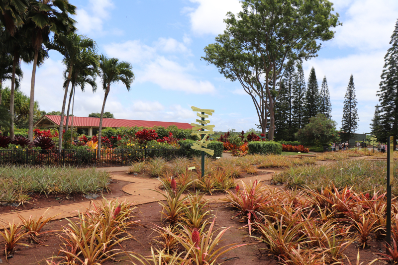
The pineapple field along the Kamehameha Hwy around the Dole Plantation was much smaller than I imagined before my visit. As I had precisely learned about the history of Hawaii I thought that the Dole Company must have been huge and dominant on Oahu island. I was surprised to see the unused field and looked into some information on the revenue from farming, and found that revenue from nuts and coffee stand high, but that from pineapples was really small. The management of the company seemed to be hard. I had nothing to feel in the Dole Plantation, but "Dole" reminded me of a historical fact like the following.
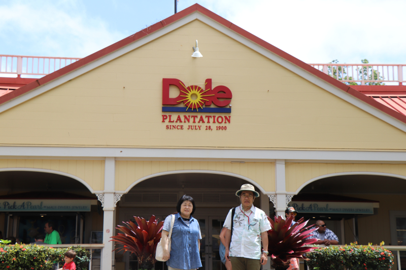
In the first picture you see "SINCE 1900". It's 2 years after the annexation of Hawaii. Do you know how the Hawaii islands were annexed into the U.S.? The U.S. sent lots of friendly Americans to the Hawaii islands and when the population of the U.S. citizens reached an absolute majority, the U.S. forced the Kingdom of Hawaii to hold what you call a democratic election to establish a U.S.-friendly government. Dole, the founder of the Dole Company, was the ringleader of that plan. His unfair way was just the same as the way that the U.S. adopted half a century ago in the battle with Mexico. They robbed Mexico of Texas, saying "Remember Alamo". What's more, when the U.S. engaged in the Great East Asian War, they fought in the same way as they did against Mexico, saying "Remember Pearl Harbor". I'm going to write about this theme later in detail.
You know, the Americans tell us that they developed wild land with pioneer spirit in heart, but it's totally and absolutely wrong. They slaughtered numerous native people and deprived them of their land. They proceeded to the west and reached Hawaii and then Japan. One of the history textbooks, published by McGraw-Hill, contains unbelievably malicious stories. I'm going to specify the real story about Hawaii for the young and promising American people.
When the U.S. citizens were inhabiting the Hawaii islands, the Royal House of Hawaii asked Japan for help, feeling that the U.S. was trying to occupy Hawaii. Unfortunately, however, Japan didn't have enough power to save the Hawaiian Royal Family. Then the king of Hawaii, Kalakaua, was the first overseas chief of state, who visited Japan. His name remains in Kalakaua Avenue, which goes through Waikiki, and I ran on the avenue, thinking of him.
The Queen Lili'uokalani was enthroned in 1891. You might know, but she's known as the writer of "Aloha Oe". Cowardly Dole plotted to run the government in the U.S.'s favor and gave the voting rights to only the white and very few islanders. On the other hand, the queen announced that she'd bestow the rights to vote on all the islanders. Lots of native islanders took to the street to support the queen, but the movement finally triggered the destruction of the Kingdom of Hawaii by the U.S. side. The native islanders' demonstration was held in front of Iolani Palace, and this palace is the singular palace in the U.S. which remains today. I ran the half-marathon on the street in front of the palace, recalling the historical incident which had broken out 127 years ago. The U.S. minister to Hawaii, Stevens, commanded the U.S. marines on the battleship Boston dispatched to Honolulu military port to take the queen in custody on the excuse that he would save the lives and properties of the U.S. citizens. At that time, the Kingdom of Hawaii disappeared from the world, and the Republic of Hawaii was established. Stevens was going to annex the Hawaii islands into the U.S. in good time.
What, do you think, did Japan do concerning the incident? Japan dispatched two warships, "Naniwa" and "Kongoh" to Hawaii and both anchored on both sides of battleship Boston just like they would do in a pincer attack. Their behaviour was nothing but overpowering. You'd be surprised to know this act of Japan, which hasn't been able to rescue abducted people from North Korea.
The captain of "Naniwa" was Heihachirou Togo, who had suddenly become famous as a great admiral later during the Russo-Japanese War. Togo declared that a reckless attempt to destroy the Kingdom of Hawaii by violence was going on, and they would keep security and protect the lives of innocent citizens. The two warships stayed in Honolulu Harbor for three months. They went back to Japan once, but "Naniwa" was sent to Hawaii again the next year.
Togo was asked to fire a gun salute to mark the first anniversary of the Republic of Hawaii by the president, but he firmly refused his proposal, saying that he didn't think that the gun salute was necessary. Consequently, other military vessels on Honolulu bay followed Togo. The news media from all over the world reported that the day of celebration had silently passed just like mourning the Kingdom of Hawaii. That's Japan's conscience, which the U.S. hasn't had even until now.
Japan showed its Navy's power off and lots of Japanese historians explain that the U.S. started to think of Japan as its enemy at that time, but I don't think so. I suspect that the refusal of the gun salute might have triggered the disgust against Japan among the U.S. citizens.


訪問前、一面に拡がるパイナップル畑を想像していたが、カメハメハ・ハイウェイの両側のパイナップル畑は荒廃していて驚いた。調べてみるとハワイ州の農産物収入はコーヒー、ナッツ類が上位を占めパイナップルは微々たるものだ。経営は楽ではなさそうだ。この場所には特に感慨は無い。ただ、ドールと聞いて思い出すことがある。
最初の写真にドール・プランテーションは1900年創業とある。ハワイ併合の2年後だ。ハワイがどのような経緯でアメリカ領となったのか。アメリカは友好的な顔でアメリカ人の入植を進め、ある程度の人口に達した時点で民主主義に則り公平に選挙をするという口実で親米政権を打ち立てた。このときの中心人物がドール、この会社の創立者だった。彼の卑怯なやり方はその半世紀前にメキシコからテキサスを奪ったときと同様の手口だった。このとき、アラモ砦に籠城する仲間をまず殺させておいてから『アラモ砦を忘れるな』という掛け声でメキシコからテキサスを奪った。後に書くが、真珠湾を攻撃させておいてから『パールハーバーを忘れるな』といいながら日本と戦ったように。
未開の地を開拓してきたとアメリカ人は言う。それは違う。先住民族を虐殺し、彼らの土地を奪ってきたのが彼らの歴史、西へ西へと進み、行き着いた先にハワイがあり、日本があった。アメリカの歴史教科書、例えばマグロウヒル社のものを読むと嘘ばかり。ここでハワイの本当の歴史をアメリカの若者のために書いておく。
アメリカ人が続々と入植していた頃、ハワイ王室は日本に助けを求めたが日本にはハワイ王国を救うだけの国力は無かった。救いを求めてやって来たカラカウア王は日本へやってきた初めての外国の元首だった。今ではワイキキを貫く大通りの名前になっていて、そんなことを思い出しながらマラソンを走った。
1891年リリウオカラニ女王が即位。あの『アロハ・オエ』の作者と書けば知らない人はいないだろう。卑怯なドールが白人の意見が通るように、白人とごく一部の島民にしか与えなかった選挙権を女王は貧しい島民にも与える憲法改正を発表したところ、イオラニ宮殿前に数千人のハワイ人が集まって女王支持のデモを行った。しかしこれはアメリカにとっては都合が悪い。白人側はこれを機に一気に王制打倒に動き出した。(イオラニ宮殿は現存しており、マラソンコースから広場を眺めた。127年前にここで起きたことを想像しながら。)米国公使スティーブンスは「米国人市民の生命と財産を守るために」と言ってホノルル港に停泊中の米軍艦「ボストン」の海兵隊を上陸させて女王を退位させ、ここにハワイ王国は消滅し、ハワイ共和国が樹立され、頃あいを見て米国は併合しようという計画だった。
しかし、当時の我が国がこの状況を放置するはずがない。北朝鮮に拉致された人たちを救えない日本にもこんな時代があったのだと驚くが、巡洋艦「浪速」、コルベット級「金剛」がホノルル港に入り、ハワイ王国乗っ取り中の戦艦「ボストン」をはさむように投錨した。威圧である。
「浪速」の艦長は東郷平八郎。後に日本海海戦を指揮して世界に勇名を馳せた名提督だ。東郷平八郎は、「武力でハワイ王制を倒す暴挙が進行している。我々は危険にさらされた無辜の市民の安全と保護に当たる」と宣言した。「浪速」は3ヶ月ハワイに留まった後、いったん帰国するも、一年後に再びホノルル湾に派遣された。
ハワイ共和国大統領から「建国一周年」を祝う礼砲を要請されたが、東郷艦長は「その理由を認めず」と拒絶。するとホノルル軍港の各国軍艦も東郷にならい、世界の新聞は「ハワイ王朝の喪に服するような静寂の一日に終わった」と伝えた。これがアメリカにはない日本の良心である。
日露戦争で日本はその海軍力を世界に見せつけた。この時点でアメリカが日本を敵国と見なすようになったという意見があるが、僕はこの礼砲拒否あたりからではないかと考えている。
Recent Comments